Description
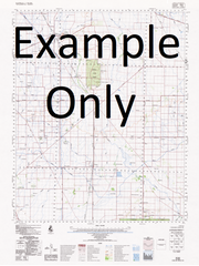
This Topographic Map is produced by Geoscience Australia; Australia's national geospatial organisation.
GA topographic maps (many of which are produced in partnership with the Army) are generally older than those maps produced by the State Governments over the same area. This makes GA maps particularly useful for identifying historic features, such as old mines and diggings.
Geoscience Australia maps generally considered to be more pleasing in design and compilation then the more modern State Government productions.
At this scale, 2cm on this map represents 1km on the ground. A standard map (which is square) covers an area of approximately about 25km by 25km, with a contour interval of 10m. This map contains natural and constructed features including road and rail infrastructure, vegetation, hydrography, contours, localities and some administrative boundaries.
Please note the date of the map, as this will impact the currency of information, particularly regarding infrastructure, roads, etc.
Bundaleer Mount View Ryecroft Thors Lodge Talinga Park Moora Gisborne Park Clearview Hillview Emu Bottom Breakneck Farm St John Lane Stud Glencairn Valisa Cloncoe Green Hills Tarbert Glasheens Gnotuk Park San Siro Kuluomba Trafalgar Lodge Toolern Park Bimbadeen Melton Park Middle Park Stud Braemar Linton Park Hilton Djerriwarrah Creighton Ridham Park Brooklyn Park Melton Stud Paceway Stud Stoneleigh Warrawong Clare Park Strathtulloch Mount Cottrell Diggers Rest Melton Rockbank Sunbury Bald Hill Black Hills Blind Creek Boardman Memorial Reserve Boggy Creek Bullengarook Burke Hill Buttlejorrk Cabbage Tree Hill Caroline Springs College Caseys Hill Coburn Primary School Deverall Hill Diggers Rest Primary School Djerriwarrh Djerriwarrh Creek Djerriwarrh Reservoir Djerriwarrh Special Developmental School Eric Boardman Memorial Reserve Evans Street Wildflower Grassland Exford Bridge Exford Primary School Fitzgerald Hill Flagstaff Hill Fogarty Field Gilbys Hill Green Hill Harry Allen Reserve Holden Ian Cowie Recreation Reserve Jacksons Park Kismet Creek Kismet Park Primary School Kororoit Kororoit Creek Kororoit Creek Eastern Branch Kororoit Creek Western Branch Kurunjang Secondary College Langama Park Leo O'Brien Reserve Little Bullengarook Macpherson Park Melton Magistrates Court Melton Police Station Melton Primary School Melton Regional Shopping Centre Melton Reservoir Melton Secondary College Melton Shire Melton South Primary School Melton West Primary School Mount Aitken Mount Bullengarook Mount Carberry Mount Gisborne Mount Holden Mount Misery Mount Tophet Norm Raven Reserve Norwood O'Brien Hill Parkwood Green Primary School Penfield Aerodrome Peter Shepherd Footbridge Red Rock Rockbank Primary School Rutland Square Sheoak Hill Sunbury Special School Wilson Park Secondary College Stringybark Hill Sugarloaf Sunbury Secondary College Sunbury Post Primary School Sunbury Heights Primary School Sunbury Magistrates Court Sunbury Police Station Sunbury Post Office Sunbury Primary School Sunbury Village Green Sunbury West Primary School Sydenham West Primary School Toolern Toolern Creek Toolern Vale Toolern Vale Primary School Wanginu Park Warrensbrook Faire Western Hill Yangardook Yangardook Creek Lerderderg River Melton South Staughtons Siding Exford

