
GA 8128
Yanco
Digital Products: You will receive an email shortly after checkout containing links to download your products.
If you do not receive this email within 30min, please check your Junk / SPAM email folder, prior to contacting us.
Description
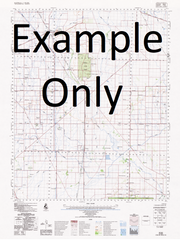
This Topographic Map is produced by Geoscience Australia; Australia's national geospatial organisation.
GA topographic maps (many of which are produced in partnership with the Army) are generally older than those maps produced by the State Governments over the same area. This makes GA maps particularly useful for identifying historic features, such as old mines and diggings.
Geoscience Australia maps generally considered to be more pleasing in design and compilation then the more modern State Government productions.
At this scale, 1cm on this map represents 1km on the ground. A standard map (which is square) covers an area of approximately 54km by 54km, with a contour interval of 20m. This map contains natural and constructed features including road and rail infrastructure, vegetation, hydrography, contours, localities and some administrative boundaries.
Please note the date of the map, as this will impact the currency of information, particularly regarding infrastructure, roads, etc.
Leeton Whitton Yanco Avenue Amesbury Anglers Bend Back Creek Back Creek Gully Banandra Banandra State Forest Bareena Creek Bikini Beach Billenbah Reserve Billenbah State Forest Black Park Black Flat Bingagong Boomerang Beach Boona Channel Boona State Forest Brians Creek Broad Beach Catfish Corner Central Park Chinamans Hole Colaragang Coleambally Canal Coleambally Catchment Drain Coleambally Channel No 3 Coleambally Channel No 4 Coleambally Channel No 5 Coleambally Channel No. 7 Coleambally Channel No. 8 Coleambally Channel No. 9a Coleambally Channel No 10 Coleambally Channel No 11 Coleambally Irrigation Area Colkmannan Colombo Creek Coononcoocabil Lagoon Corbie Hill Corbie Hill Public School Corobimilla Cuba Cuba State Forest Cuddell Cuddell Creek Cudgel Cudgel Sandhills Channel Cudgel Sandhills Cunninghams Beach Dallas Darlington Lagoon Darlington Point Post Office Darlington Point Public School Darlington Point Enticknap Park Eulo Euroley Creek Euroley State Forest Euwarderry Lagoon Fivebough Fivebough Swamp Gidgell Gillenbah Plain Gogeldrie Gogeldrie Branch Canal Gogeldrie Main Southern Drain Gogeldrie Weir Goonerah Lagoon Gooragool Lagoon Graham Park Gralee Gralee Public School Grants Regulator Guises Creek Gum Hole Hebdens Bend Horn Beach Horseshoe Lagoon Howell Hulong Island Beach Jurambula Kemmel Hill Corobimilla Railway Station Cowshed Hill Cudgel Creek Egansford Public School Five Bough Fivebough Public School Gidgell Public School Gogeldrie Public School Gogeldrie Railway Station Koorumbeen Channel Lady Jane Beach Laments Beach Lamonts Beach Leeton Agricultural Research Station Leeton High School Leeton Post Office Leeton Public School Leeton Racecourse Leeton Railway Station Leeton Showground Leeton Technical College Long Beach Mccaugheys Lookout Mccaugheys Pumphole Markeys Beach Matangry Lagoon Mantangary Lagoon Melbergen State Forest Merungle Merungle Hill Merungle Hill Public School Merungle Hill Reserve M.I.A. Forest Mollys Lagoon Morundah Morundah Public School Morundah Railway Station Morundah Regulator Mountford Park Muddy Creek Murdering Sandhills Murrumbidgee State Forest Nandirong Bend Nandrigong Bend Narrancoolambund Lagoon Narrancoolambung Lagoon New Park New Park Railway Station Ourendumbee Parkview Parkview Public School Pine Watercourse Platt Beach The Point Beach Point Beach Powerhouse Lagoon Prickly Regulator Pulletop Creek Quarry Hill Red Gum Point Reserve Beach Roach Roach Railway Station Roachs Escape Roachs Regulator Sandy Beach Schmetzers Bend Ski Beach South Gogeldrie Public School Spillers Creek Stanbridge Stanbridge Public School Stanbridge Swamp Stephens Stick Lagoon Sturt Canal Tombullen Creek Tombullen Regulator Tombullen Storage Tombullen Swamp Tom Grogans Lagoon Tubbo Tubbo Channel Tuckerbil Ungundury Lagoon Uroly Waddi Creek Waipukurau Park Wamoon Wamoon Public School Waradgery Beach Washpen Creek Wattle Hill Waugh Whitton Common Whitton Public School Whitton Punt Reserve Whitton Railway Station Willbrigee State Forest Willbriggie State Forest Willimbong Wiradjeri Wiradjuri Woolshed Creek Yamma Yanco Agricultural College and Research Station Yanco Creek Yanco Agricultural High School Yanco Irrigation Area Yanco Post Office Yanco Public School Yanco Railway Station Yanco Weir Yanko Creek Yanko Plain Yarabee Yarangery Yarangery Creek Yarramungueer Lagoon Diggers Beach Dooley Park Dry Lake The Dry Lagoon Bundure Channel Bundure No 1 Channel Bundure No 2 Channel Bundure No 3 Channel Burt Euroley Buckingbong Flora Reserve Pulletop Nature Reserve Middle Beach Forest Park Wattle Hill Reservoir Five Bough Swamp Waddi Roach Station Caringal Tuegan Cudgeli Creek Tubba Wells The Chace Oak Vale Riverina