
GA 9232-1
Clarence Town
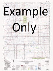
Description
This Topographic Map is produced by Geoscience Australia; Australia's national geospatial organisation.
GA topographic maps (many of which are produced in partnership with the Army) are generally older than those maps produced by the State Governments over the same area. This makes GA maps particularly useful for identifying historic features, such as old mines and diggings.
Geoscience Australia maps generally considered to be more pleasing in design and compilation then the more modern State Government productions.
At this scale, 2cm on this map represents 1km on the ground. A standard map (which is square) covers an area of approximately about 25km by 25km, with a contour interval of 10m. This map contains natural and constructed features including road and rail infrastructure, vegetation, hydrography, contours, localities and some administrative boundaries.
Please note the date of the map, as this will impact the currency of information, particularly regarding infrastructure, roads, etc.
Bo-Villa Clarence Town Karuah Medowie Allworth Armsleys Creek Armsleys Gully Back Island Baldy Knob Balickera Canal Ballacara Ballacara Hill Baltimore Hill Bato Bato Point Berkley Park Big Swan Bay Boatfall Creek Blanchs Jetty Blackbrook Blackbrook Hill Boogee Boogee Island Boyd Oval Brewers Creek Bridge Creek Bulga Creek Camerons Creek Campvale Swamp Captain Hills Creek Carcair Point Caswells Creek Cherry Gully Clarence Town Falls Clarence Town Park Clarence Town Public School Clay Hill Cockle Shell Point Correebah Island Cromarty Creek Crystal Creek Davis Point Deep Creek Eagleton Edith Waters Reserve Eldon Euwylong Evens Point Feeney Park Ferodale Point Flaggy Creek Gilmore Hill Gilmore Lookout Glen Martin Glen William Glen William Public School Grahamstown Lake Half Moon Brush Hells Gates Hickson Hilliers Creek Hobarts Creek Horse Island Horton Ironstone Mountain Irrawang Irrawang High School Irrawang Swamps Isaacs Gully Joass Island Karinya Karuah Cemetery Karuah Public School Karuah State Forest Capps Cemetery At Karuah Cherry Creek Corribah Island Eagleton Public School Evans Point Evens Jetty Flying Fox Island Galloping Swamp Mount Gillmore Grahamstown Swamp/Grahamstown Storage Reservoir Greens Island Hamilton Isaacs Creek Karuah Aboriginal School Kertchleys Island Killaloe Public Wharf Kings Cave Kings Hill Kitchener Island Lillies Point Limeburners Limeburners Creek Little Mountain Little Swan Bay Lizzies Creek Mcmanus Creek Mahers Knob Medowie Public School Medowie State Forest Memorial Park Meridian Park Millars Hill Millers Hill Mill Flat Falls Moffats Swamp Moffats Swamp Nature Reserve Montrose The Moors Morans Point Mosman Swamp Mostons Creek Mud Island Mullwee Mulwee Mulwee Public School Muree Chase Mustons Creek Mustons Gully Nargoon Reserve Nine Mile Creek Number One Cove Orobilbah Island Orobillah Island Orobilbah Orobillah Oyster Cove Paddys Hill Pelican Island Pipeclay Creek Plateau Pretty Hill Racecourse Swamp Raymond Terrace Red Gums Reedy Creek Ringwood Ringwood Flat Roslyn Park Rowlands Falls Saltwater Creek Sansons Flat Sawyers Sawyers Point Sawyers Point Wharf Sawyers Reservoir Scobies Hill Scobies Mountain Seaham Seaham Hill Mount Seaham Seven Mile Creek Shell Point Sinclairs Hill Sisters Creek Sketchleys Island Snapes Creek South Wambo Creek Stoney Creek Stony Creek Stowell Sunrise Point Sunset Park Sunset Point Sutton Swampy Island Swan Bay Swan Bay Estate Swan Island Swan Park Tanilba Tanilba Bay Tanilba Park Tanilba Point Tarean Tarean Creek Tattersals Tattersalls The Gap Thornton Twelve Mile Creek Wallaroo Flora Reserve Wallaroo Hill Wallaroo Mountain Wallaroo State Forest Wallaroo Swamp Wilmot Wirreanda Public School Wirrung Island Wundabalaynbah Point Yalimbah Creek Yulong Park Doribank Flat Double Wharf Dividing Range Doribank Doribank Swamp Double Creek Part Of Double Creek Butlers Flat Allworth Park Billygoat Hill Clarence Town Memorial Park Longworth Park Balickera Ferodale Centennial Park Elaine Hurst Oval Ashtonfield Public School Medowie Lions Park Brookfield Unwarrabin Creek Nolans Creek Black Camp Creek Lyndon Holbrook Glenwilliam Cameron Creek Glenmartin Glendon Larpent River Branch River Little Branch Creek Wolleroo Creek Tumbledown Creek Sinclairs McManus Creek Karuah River Burnbrae Yalimba Creek Tahlee Seaham Mountain Dorisville Cockleshell Point Irrawang Swamp Pine Lodge Grahamstown Swamp Fodermead Phillips Point Williams River Port Stephens Shire Camp Vale Swamp