
NSW 7129-N
Cal Lal
Digital Products: You will receive an email shortly after checkout containing links to download your products.
If you do not receive this email within 30min, please check your Junk / SPAM email folder, prior to contacting us.
Description
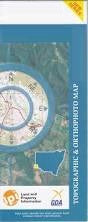
This Topographic Map is produced by the New South Wales Government.
This map is supplied in digital in PDF format, which means it can be printed at home or sent to a professional printer for a 100% scale reproduction.
At this scale, 2cm on this map represents 1km on the ground. A standard map (which is square) covers an area of approximately about 25km by 25km, with a contour interval of 10m. This map contains natural and constructed features including road and rail infrastructure, vegetation, hydrography, contours, localities and some administrative boundaries.
Kulkurna Tai Hu Farm Nampoo Lake Victoria Lindsay Point Berribee Neds Corner Backwater Backwater Lagoon Big Rigamy Creek Boundary Creek Brilka Creek Bulka Creek Cal Lal Cal Lal Cemetery Devils Elbow Elphicks Island Frenchmans Creek Goose Neck Rocks Hancock Hancock Hill Higgins Cutting Horseshoe Billabong General Cemetery Tareena Lake Victoria State Forest Lindsay Cliffs Little Frenchmans Creek Little Rigamy Creek Lock No 7 Lock No 8 Mount Hancock Mungo Creek Pollard Island Pollards Cutting Pollards Island Reedy Island Rigamy Creek Rufus Reach Rufus River Shoal Reach The Occupation Wangumma State Forest Walkminga Wangumma Warpa MacCabe Corner Rufus Todd-Smalley Line Hypurna Creek Berribee Tank Five Mile Tank Lake Wallawalla Lindsay Island Lindsay River Lock No. 7 Lock No. 8 Mullaroo Creek Mullroo Oaks Tanks Olney Potterwallkagee Creek Tourpnein Creek Warina Woolwoola Big Bend Lock Number Seven Lock Number Eight