
NSW 7133
Thackaringa
Digital Products: You will receive an email shortly after checkout containing links to download your products.
If you do not receive this email within 30min, please check your Junk / SPAM email folder, prior to contacting us.
Description
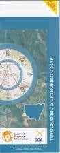
This Topographic Map is produced by the New South Wales Government.
This map is supplied in digital in PDF format, which means it can be printed at home or sent to a professional printer for a 100% scale reproduction.
At this scale, 1cm on this map represents 1km on the ground. A standard map (which is square) covers an area of approximately 54km by 54km, with a contour interval of 20m. This map contains natural and constructed features including road and rail infrastructure, vegetation, hydrography, contours, localities and some administrative boundaries.
Forders Hut Mount George White Leeds Thackaringa The Pinnacles Balaclava Hillston Ascot Vale Coultra Oakdale Enmore Sunny Dale Pine Point Wonga Burta Acacia Creek Broken Hill Aerodrome Broken Hill Airport Camels Humps Felspar Felspar Creek Georges Creek Harry Harry Creek Hawson Hawsons Knob Kellys Creek The Camels Hump Harrie Harrie Middle Pinnacle Mootbora Creek New Well Creek North Pinnacle Sentinel Sentinel Hill South Pinnacle Stirling Vale Creek Thackaringa Creek Thackaringa Creek or Rocky Creek Thackaringa Hills Thackaringa Loop Thackaringa Railway Station Thackaringa Siding Thackaringa Tank Thackaringa Pinnacles The Little Peak The Sentinel Twenty Mile Wallarunga Burns Burta Creek Mootooroo Creek Doon Putta Wanga West Wendi Albert Alma Coombarra Dhoon Edgar Hughes Ophara Victoria Soudan Pinnacles Mine Cockburn The Big Hill Lady Beryl Mine Lambing Camp