
NSW 7134
Broken Hill
Digital Products: You will receive an email shortly after checkout containing links to download your products.
If you do not receive this email within 30min, please check your Junk / SPAM email folder, prior to contacting us.
Description
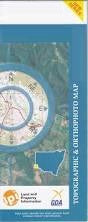
This Topographic Map is produced by the New South Wales Government.
This map is supplied in digital in PDF format, which means it can be printed at home or sent to a professional printer for a 100% scale reproduction.
At this scale, 1cm on this map represents 1km on the ground. A standard map (which is square) covers an area of approximately 54km by 54km, with a contour interval of 20m. This map contains natural and constructed features including road and rail infrastructure, vegetation, hydrography, contours, localities and some administrative boundaries.
Poolamacca Eldee Purnamoota Nine Mile Belmont ruins Mundi Mundi Acacia Vale Limestone Green Acres Peak Hill abandoned Stirling Vale Broken Hill Silverton Gum Creek Acacia Siding Acacia Creek Big Aller Creek Black Hill Creek Mount Black Hill or Eurodo Blue Anchor Blue Anchor Tank Black Hill Bomangaldy Hill Brewery Creek Broken Hill Cemetery Broken Hill High School Broken Hill Post Office Broken Hill Public School Broken Hill Railway Station Broken Hill South Base Broken Hill Sportsground Broken Hill Technical College Cartwrights Creek Cusin Creek Democrat Creek Dense Camp Creek Eldee Creek Mount Ellie Mount Franks Imperial Lake Reserve Kanandah Siding Kennys Hill Gum Creek Part Of Gum Creek Part of Wookookuroo Creek Lakes Creek Lakes Grave Creek Lakes Knob Lakes Nob Limestone Bore Little Aller Creek Little Star Creek Mount Lookout Lords Gorge Mindioomballa Creek Mindioomballa or Dry Creek Morgan Street Public School Mount Eltee Mundi Mundi Creek Mount Mundi Mundi Mundi Mundi Plain Mundi Mundi Plains Mundi Mundi Range Nine Mile Creek The Nine Mile Creek One Mile Creek One Tree Hill Para Creek Para Gully or Little Aller Creek Parnell Creek Polygonum Swamp Poolamacca Creek Purnamoota Creek Village of Purnamoota Queen Elizabeth Park Rathole Rathole Creek Rathole Tank Rathol Red Hill The Red Hill Robe Mount Robe Robe Range Rock Hole Creek Sandy Gum Creek Silver King Creek Silverton Cemetery South Base Star Creek Stephen Sundown Mount Umberumberka Umberumberka Reservoir Umberumberka Storage Reservoir Umberumberka Umberumberka Creek Willyama Willyama High School Wookookaroo Creek Wookookuroo Creek Woolshed Tank Vangulla or Big Aller Creek Burke Ward Public School Barrier School Silverlea School J P Keenan Lookout Mundi Mundi Nature Reserve Corruga Flat Top Lewis Hill O'Neill Park Penrose Park Wills Street Infants School Morris's Blow Alma Bomangaldy Bray Carrington Jamieson Lewis Meadows Mount Gipps Nadbuck Naradin Picton Thackaringa Yangalla Elti Cochra Well The Paps Mount Robie Barrier Ranges Seventy Mile Plain Peak Hill Broken Hill Municipality ONeill Park Mount Eurodo