
NSW 7137
Smithville
Digital Products: You will receive an email shortly after checkout containing links to download your products.
If you do not receive this email within 30min, please check your Junk / SPAM email folder, prior to contacting us.
Description
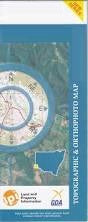
This Topographic Map is produced by the New South Wales Government.
This map is supplied in digital in PDF format, which means it can be printed at home or sent to a professional printer for a 100% scale reproduction.
At this scale, 1cm on this map represents 1km on the ground. A standard map (which is square) covers an area of approximately 54km by 54km, with a contour interval of 20m. This map contains natural and constructed features including road and rail infrastructure, vegetation, hydrography, contours, localities and some administrative boundaries.
Smithville House Lake Wallace Moorabie Old Quinyambie Border Downs Turleys House Big Salt Lake Lake Boolka Box Creek Brown Salt Lake Caroo Watercourse Cuthajerry Plain Deadmans Swamp Duncans Swamp Lake Ellis Four Mile Swamp Frenchys Lake Green Lake Little Salt Lake Lake Muck Neals Dugout Packsaddle Creek Poison Swamp Soda Hole Starvation Lake Sulphur Lake Surveyors Waterhole Lake Want Turleys Aamurre Waterhole Box Water Hole Boulka Broughton Haynes Moolook Pidgerie Pingally Quinyambi Wheeland Whitty Wobaduck Wygah Nardoo Yandaminta Creek Stokies Bore Pincally Ten Mile Bore Quinyambie Gravel Creek