
NSW 7236
Bancannia
Digital Products: You will receive an email shortly after checkout containing links to download your products.
If you do not receive this email within 30min, please check your Junk / SPAM email folder, prior to contacting us.
Description
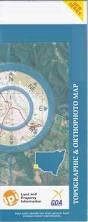
This Topographic Map is produced by the New South Wales Government.
This map is supplied in digital in PDF format, which means it can be printed at home or sent to a professional printer for a 100% scale reproduction.
At this scale, 1cm on this map represents 1km on the ground. A standard map (which is square) covers an area of approximately 54km by 54km, with a contour interval of 20m. This map contains natural and constructed features including road and rail infrastructure, vegetation, hydrography, contours, localities and some administrative boundaries.
Wyndonga Yelka Packsaddle The Veldt Nundooka The Selection Bancannia Lake Bancannia Tank Bancanya Lake Barons Creek Coko Creek Coko Range Cuban Hole Floods Creek Folly Creek Fowlers Creek Gap Hills Tank Coco Range Gum Creek Koko Creek Lake Windaunka Little Bancannia Lake Nundooka Creek Packsaddle Bore Packsaddle Hill Packsaddle Mountain Pinnacles Hill Poison Corner Queing Pen Tank Sandy Creek Sandy Creek Bore Sheperds Lake Shepherds Lake Swan Lake Tabletop Creek Telephone Creek The Pinnacle Windaunka Lake Wyalla Lake Wyndonga Lake Bull Oak Creek Double Tanks Yancarraman Giles Table Top Boorla Coyurunda Mulcawee Teltawongee Windaunka Yangimulla Tucinyah The Packsaddle Bore Lake Bancannia Tangarto Tank