
NSW 7430
Arumpo
Digital Products: You will receive an email shortly after checkout containing links to download your products.
If you do not receive this email within 30min, please check your Junk / SPAM email folder, prior to contacting us.
Description
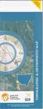
This Topographic Map is produced by the New South Wales Government.
This map is supplied in digital in PDF format, which means it can be printed at home or sent to a professional printer for a 100% scale reproduction.
At this scale, 1cm on this map represents 1km on the ground. A standard map (which is square) covers an area of approximately 54km by 54km, with a contour interval of 20m. This map contains natural and constructed features including road and rail infrastructure, vegetation, hydrography, contours, localities and some administrative boundaries.
Carstairs Peaka Balranald Gate Top Hut Old Arumpo Arumpo Murragi Petro Chibnalwood Bellnar Marma Arumpo Creek Lake Arumpo Arumpo Tank Andersons Water Hole Baldwins Tank Balranald Gate Tank Billygoat Hill Bulbugaroo Dry Lake Bulbugaroo Lake Canegrass Tank Franks Tank Junction Tank Franks Plains Tank Middle Tank Mundonah Bore Neighbors Tank Neighbours Tank Ravine Tank Tourtmundo Tank Bullocky Tank Bunchie Hollow Bunchie Tank Bunchie Annand Bullanmong Buraguy Coonpa Letheroe Mindelwul Moangola Murnowella Nundrower Poimba Pondery Pulpa Roma Thoomby Uki Ulong Connargee Burrie Bonparker Tank Scrub Hut Tank Arumpo Lake Arumpo House Marragi