
NSW 7528-S
Kyalite
Digital Products: You will receive an email shortly after checkout containing links to download your products.
If you do not receive this email within 30min, please check your Junk / SPAM email folder, prior to contacting us.
Description
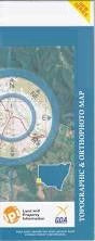
This Topographic Map is produced by the New South Wales Government.
This map is supplied in digital in PDF format, which means it can be printed at home or sent to a professional printer for a 100% scale reproduction.
At this scale, 2cm on this map represents 1km on the ground. A standard map (which is square) covers an area of approximately about 25km by 25km, with a contour interval of 10m. This map contains natural and constructed features including road and rail infrastructure, vegetation, hydrography, contours, localities and some administrative boundaries.
Bindee Wilga Park Malado Farm Sinapius Murray Bank Bests Sandbar The Big Bend Bitch and Pups Bingera Creek The Bucca Wakool Bucky Creek Bucky Island Canally Island Four Corners Goodnight Gundagai Bend Horseshoe Lagoon Howleys Bend Kyalite Kyalite Public School Lockharts Sandbar Mallee Milleu Mortons Lagoon Mortons Sanctuary Narrung Cutting Talbetts Crossing Tarara Crossing Tararie Wakool Wakool Crossing Wakool Junction Lake Wannah Wee Wee Creek Windomal Windomal Landing Bungaree Creek Byerley Bend Murray Plain Pin Cushion Island Gendarme Bend Graveyard Bend Chadwick Bridge Creek Burra Burra Channel Burra Creek Byerleys Bend Coonimur Hastings Tank Channel Heywoods Lake Kooloonong Koorkab Macredie Island Mirkoo Narrung Narrung Channel Natya Natya Telephone Exchange Piambie Pines Possum Flat Channel Tyntynder Main Channel Wakool Creek Yungera Junction Park Heywood Lake Allanvale Haysdale Wakool River Thistlebank Kyalite River Edward River