
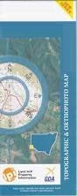
NSW 7628-N
Balranald
Digital Products: You will receive an email shortly after checkout containing links to download your products.
If you do not receive this email within 30min, please check your Junk / SPAM email folder, prior to contacting us.
Description
This Topographic Map is produced by the New South Wales Government.
This map is supplied in digital in PDF format, which means it can be printed at home or sent to a professional printer for a 100% scale reproduction.
At this scale, 2cm on this map represents 1km on the ground. A standard map (which is square) covers an area of approximately about 25km by 25km, with a contour interval of 10m. This map contains natural and constructed features including road and rail infrastructure, vegetation, hydrography, contours, localities and some administrative boundaries.
Balranald Avalon Lake Town of Balranald Balranald Aerodrome Balranald Cemetery Balranald Central School Balranald Public School Balranald Railway Station Belar Benongal Bottle Gate Creek Breer Creek Chadwick Chaston Cutting Condoulpe Creek Devils Creek Fisher Greenham Park Impimi Gum Creek Kia Kia Lake Kia Ora Kia Swamp Kieeta Kieeta Creek Kieeta Game Reserve Lincoln Loorica Lake Mamanga Morris Muttiedaddie Reserve Nap Nap Tank Nimming Pollen Creek Nolans Chance Lake Parker Pee Vee Creek Pollen Creek Tala Tala Creek Lake Tala Talpee Creek Teatree Lake Telford The Bottleneck The Willows Torry Plains Game Reserve Uara Creek Williamson Willow Vale Wombah Woolshed Creek Yanga Yanga Creek Yanga Lake Yangalake Railway Station Yanga Nature Reserve Yanga State Forest Burdakiany or Tala Creek Balranald Reservoir The Gum Creek Balranald Aboriginal Cemetery Bourpie Escape Chaston Regulator Glen Avon Escape Kieeta Escape Tala Escape Abercrombie Channel Loorica Pybolee Wilpee Paika Yarrington Waugorah Kieeta State Forest Wynburn Springbank Warwaegae Auleg Ti Tree Lake Yanga Tank