
NSW 7726-N
Barham
Digital Products: You will receive an email shortly after checkout containing links to download your products.
If you do not receive this email within 30min, please check your Junk / SPAM email folder, prior to contacting us.
Description
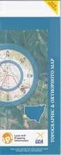
This Topographic Map is produced by the New South Wales Government.
This map is supplied in digital in PDF format, which means it can be printed at home or sent to a professional printer for a 100% scale reproduction.
At this scale, 2cm on this map represents 1km on the ground. A standard map (which is square) covers an area of approximately about 25km by 25km, with a contour interval of 10m. This map contains natural and constructed features including road and rail infrastructure, vegetation, hydrography, contours, localities and some administrative boundaries.
Burunah Scottwood Rosevale Halewood Otherside Cambra Mayfield Park Sunnyside Aldersyde Belvoir The Ridge Murijidi Abingdon Jimara Mayfield Illunga Crystalea Ellrob Bareena Glen Avon Tree Tops Creek View Willowmere Altersa Cooatalla Barham Koondrook Axe Creek Ana Branch or Wakool River Back Creek Lagoon Barber Overflow Barbers Creek Barbers Creek Backwater Barbers Lagoon Village of Barham Barham Cemetery Barham General Cemetery Barham High School Barham Mill Bend Barham Post Office Barham Public School Baysens Camp Big Bonum Big Bonum Sandhill Black Box Sandhill Bookit Creek Boundary Lagoon Box Creek Broad Creek Caldwell Caldwell Public School Calf Creek Campbells Island Campbells Island State Forest Cassidys Camp Cangan Cemetery Bend Chinaman Bend Clump Bend Cow Creek Crombie Crossing Crooked Creek Cumbungle Waterholes Danberry Deniboota Canal Escape Eagle Creek Gabo Hill Grasses Waterhole Green Gully State Forest Greys Plain Griminal Creek Gunyah Creek Horseshoe Sandhill Hudson Creek Iron Punt Landing Cobram Creek Cumbungle Depressions Greys Depresslon Koondrook State Forest Little Barbers Creek Little Bonum Little Bonum Sandhill Little Murray River Long Lagoon Mcclure Bend Mccormicks Crossing Mckenzie Bend Mcmahons Creek Mcmahons Waterhole Marah Merran Creek Merribit Creek Mia Mia Milverton Bend Mingeeunggoot Plain Moorings Lagoon Morton Bend Mortons Crossing Mosses Lagoon Myloc Myloc Creek The Neck Nelsons Crossing Nugent Bend Nunnagoyt Penglasses Landing Penny Royal Lagoon Pioneer Park Pollack Creek Pollack Lagoon Pollack Neck Pollack Swamp Porthole Porthole Creek Pothole Creek Pothole Lagoon Puggarmilly or Campbelis Island Puggarmilly State Forest Racecourse Flat The Racecourse Reeds Landing Sandys Crossing Saucer Plain Scottys Crossing Scottys Lagoon Shallow Crossing Sids Crossing Slanty Crossing Smoke House Creek Smoke House Lagoon Sovereign Bend Splitters Plain Stadium Clearing The Stadium Storms Creek Tantonan Tantonan Bore The Myloc The Rookery Thule Thule Creek Thule Lagoon Thule State Forest Thule Swamp Tittil Twin Depressions Twin Lagoon Uni Creek Vincent Bend Whymoul Lake Whymoul Yallakool Village of Yallakool Yallakool Railway Station Yarrein Creek Dewings Crossing Burnt Landing Pollack Flora Reserve Greys Swamp Lakes Crossing Old Spot Mill 399 Mile Landing Twin Lagoons Yarraman Channel Merran Cutting New Merran Cut North Barham Charbulloke East Barham Little Sandhill Toromoke Waradgery Reef Four Posts Crossing Barham Reservoir Eagle Creek Cutting Benwell State Forest Benwell Swamp Brown Bend Bullrush Lagoon Cockatoo Lagoon Cohuna Channel Condidorios Bridge Gannawarra Gannawarra Public Hall Gannawarra Siding Gannawarra Telephone Exchange Goat Island Gunbower Island Gunbower State Forest Guttram State Forest Guttram Swamp Hinksons Siding Iron Punt Lagoon James Park Kerang-Koondrook Railway Koondrook Cemetery Koondrook Environmental Reserve Koondrook Police Station Koondrook Primary School Koondrook Weir Koroop Public Hall Little Gunbower Creek Little Punt Lagoon Little Reed Bed Marshall Lagoon McCutchell Bend McDonalds Swamp McKenzie Bend McLure Bend Murrabit Myall Primary School Myall Public Hall No. 2 Swamp Piccaninny Barr Creek Red Gum Swamp Reed Bed Reedy Lagoon Renwell Swamp Sandy McNab Bend Smiths Drain Spence Bridge Teal Point Primary School Teal Point Siding Tree Tops Scout Camp Area Whistler Lagoon Yeoburn Siding Sandy Ridge Widgee Yallarkool Channel Yallahool Creek Yallakool Creek Green Hills Gunbower Creek Gannawarra Station The Wilderness Teal Point Hinksons Hinkson Yeoburn Station The Green Gully