
NSW 7727-S
Wakool
Digital Products: You will receive an email shortly after checkout containing links to download your products.
If you do not receive this email within 30min, please check your Junk / SPAM email folder, prior to contacting us.
Description
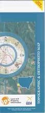
This Topographic Map is produced by the New South Wales Government.
This map is supplied in digital in PDF format, which means it can be printed at home or sent to a professional printer for a 100% scale reproduction.
At this scale, 2cm on this map represents 1km on the ground. A standard map (which is square) covers an area of approximately about 25km by 25km, with a contour interval of 10m. This map contains natural and constructed features including road and rail infrastructure, vegetation, hydrography, contours, localities and some administrative boundaries.
Wakool Belmore Beremegad Beremegad Tank Bookit Box Creek Branch Creek Chowar Christies Creek Cobwell Cockran Gonn Gynong Jimaringle Jimaringle Branch Canal Jimaringle Creek Village of Jimaringle Little Merran Creek Merran Creek Middle Creek Middle Creek Water Course Nearroongaroo Niemur Drain Niemur Main Drain Noorong Creek Reed Bed Creek Shaws Creek Simpsons Creek Taylors Creek Toolon Tullakool Tullakool Canal Tullakool Channel Village of Tullakook Wakool Public School Wakool Railway Station Village of Wakool Wandaradget Whymoul State Forest Yadabal Yadabal Lagoon Bundarra Creek Bunna Creek Burraboi Village of Burraboi Burragorrima Creek Noorong Niemur Cochrans Creek Cockran Creek Jawbone Creek Grassmere Rangemore Burrabol Gwynnes Creek Gambrie Barbers Creek North Wakool