
NSW 7728-S
Tchelery
Digital Products: You will receive an email shortly after checkout containing links to download your products.
If you do not receive this email within 30min, please check your Junk / SPAM email folder, prior to contacting us.
Description
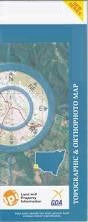
This Topographic Map is produced by the New South Wales Government.
This map is supplied in digital in PDF format, which means it can be printed at home or sent to a professional printer for a 100% scale reproduction.
At this scale, 2cm on this map represents 1km on the ground. A standard map (which is square) covers an area of approximately about 25km by 25km, with a contour interval of 10m. This map contains natural and constructed features including road and rail infrastructure, vegetation, hydrography, contours, localities and some administrative boundaries.
Baldon Big Baldon Sandhill Caroonboon Chambers Cornellees Point Gunyah Swamp Gwynne Lintets Swamp Lintots Swamp Lyle Miranda State Forest Parquin Lake Pevensey Raubelle Rawleys Lake Snaky Creek Swamp Lake Tchelery Tank Thalaka Whymoul Creek Windouran Swamp Wood Dry Lake Moulamein Clearview Tchelery Everslee North Bundy Bundyulumblah Windouran Tank