
NSW 7835
Innesowen
Digital Products: You will receive an email shortly after checkout containing links to download your products.
If you do not receive this email within 30min, please check your Junk / SPAM email folder, prior to contacting us.
Description
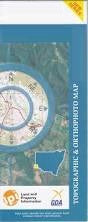
This Topographic Map is produced by the New South Wales Government.
This map is supplied in digital in PDF format, which means it can be printed at home or sent to a professional printer for a 100% scale reproduction.
At this scale, 1cm on this map represents 1km on the ground. A standard map (which is square) covers an area of approximately 54km by 54km, with a contour interval of 20m. This map contains natural and constructed features including road and rail infrastructure, vegetation, hydrography, contours, localities and some administrative boundaries.
Nangara Wyoming Burnamwood Innesowen Tiltagoonah Manara Pinchinara Windara Jacob The Lagoons Tiltagoonah Lagoons Windarra Creek Albert Bilbo Clarke Coombes Deniehy Etty Gidgiegalumba Kirkingle Munbunya Thourumble Wigilla Lawrence Gidgiegolambo Creek Tambua Creek Taltagoonah Windara Creek