
NSW 8128-1N
Leeton
Digital Products: You will receive an email shortly after checkout containing links to download your products.
If you do not receive this email within 30min, please check your Junk / SPAM email folder, prior to contacting us.
Description
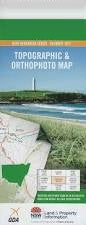
This Topographic Map is produced by the New South Wales Government.
This map is supplied in digital in PDF format, which means it can be printed at home or sent to a professional printer for a 100% scale reproduction.
At this scale, 4cm on this map represents 1km on the ground. A standard map (which is square) covers an area of approximately about 12.5km by 12.5km, with a contour interval of 10m. This map contains natural and constructed features including road and rail infrastructure, vegetation, hydrography, contours, localities and some administrative boundaries.
Leeton Yanco Amesbury Black Park Central Park Chinamans Hole Coononcoocabil Lagoon Corbie Hill Corbie Hill Public School Enticknap Park Fivebough Fivebough Swamp Gogeldrie Gogeldrie Branch Canal Gogeldrie Weir Graham Park Gralee Gralee Public School Guises Creek Hebdens Bend Kemmel Hill Cowshed Hill Five Bough Fivebough Public School Gogeldrie Public School Gogeldrie Railway Station Leeton Agricultural Research Station Leeton High School Leeton Post Office Leeton Public School Leeton Racecourse Leeton Railway Station Leeton Showground Leeton Technical College Mccaugheys Lookout Merungle Merungle Hill Merungle Hill Public School Merungle Hill Reserve Mountford Park Parkview Parkview Public School South Gogeldrie Public School Stanbridge Public School Tuckerbil Waipukurau Park Wamoon Wamoon Public School Wattle Hill Willimbong Wiradjeri Wiradjuri Yanco Agricultural College and Research Station Yanco Irrigation Area Yanco Post Office Yanco Public School Yanco Railway Station Yarangery Dooley Park Wattle Hill Reservoir Five Bough Swamp