
NSW 8129-3S
Willbriggie
Digital Products: You will receive an email shortly after checkout containing links to download your products.
If you do not receive this email within 30min, please check your Junk / SPAM email folder, prior to contacting us.
Description
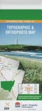
This Topographic Map is produced by the New South Wales Government.
This map is supplied in digital in PDF format, which means it can be printed at home or sent to a professional printer for a 100% scale reproduction.
At this scale, 4cm on this map represents 1km on the ground. A standard map (which is square) covers an area of approximately about 12.5km by 12.5km, with a contour interval of 10m. This map contains natural and constructed features including road and rail infrastructure, vegetation, hydrography, contours, localities and some administrative boundaries.
Davit Farm Maringa Crundle Amaroo Noenda Port-O-Call Koringal Glenwood Warrawong Kiloran Tally-Hi Wengari Wilga Casurina Mindaribba Kirana Mattara Nanaroo Cudgee Lyndella Inglewood Calorafield Brays Dam Bringan Calorafield Public School Camarooka Colchester Floods Hill Hutong Tank Little Mirrool Creek Naunton Ulong Ulong Tank Whitton Branch Canal Wilga Tank Willbriggie Willbriggie Railway Station Kooba Neeambah Station Mount Harris