
NSW 8325-4N
Lake Hume
Digital Products: You will receive an email shortly after checkout containing links to download your products.
If you do not receive this email within 30min, please check your Junk / SPAM email folder, prior to contacting us.
Description
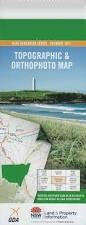
This Topographic Map is produced by the New South Wales Government.
This map is supplied in digital in PDF format, which means it can be printed at home or sent to a professional printer for a 100% scale reproduction.
At this scale, 4cm on this map represents 1km on the ground. A standard map (which is square) covers an area of approximately about 12.5km by 12.5km, with a contour interval of 10m. This map contains natural and constructed features including road and rail infrastructure, vegetation, hydrography, contours, localities and some administrative boundaries.
Talgarno Park Fairholme Essanorm Windermere Wellendban Villa Hilltop Kellpark Carinya Katoomba Rosyth Hiview Bellbridge Thurgona Thurgoona Cumboroona Hume Weir Wirlinga Hume Dam Lake Hume Village Bethanga Bethanga Creek Bethanga Fire Station Bethanga Gap Bethanga Post Office Bethanga Primary School Forest Creek Gol Creek Johnston Creek Mitta Junction Primary School Mount Talgarno Ruby Creek Talgarno Talgarno Bight Talgarno Fire Station Talgarno Primary School Talgarno Public Hall Talgarno Telephone Exchange Wise Creek Hume Reservoir Mitta Junction Bowna Creek Four Mile Creek