
NSW 8326-1S
Holbrook
Digital Products: You will receive an email shortly after checkout containing links to download your products.
If you do not receive this email within 30min, please check your Junk / SPAM email folder, prior to contacting us.
Description
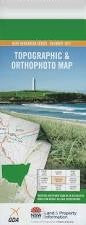
This Topographic Map is produced by the New South Wales Government.
This map is supplied in digital in PDF format, which means it can be printed at home or sent to a professional printer for a 100% scale reproduction.
At this scale, 4cm on this map represents 1km on the ground. A standard map (which is square) covers an area of approximately about 12.5km by 12.5km, with a contour interval of 10m. This map contains natural and constructed features including road and rail infrastructure, vegetation, hydrography, contours, localities and some administrative boundaries.
Holbrook Back Creek Bells Lagoon Box Box Hill Carabobala Coocook Cromer Hills Garryowen Green Holbrook Cemetery Holbrook Park Holbrook Post Office Holbrook Public School Holbrook Racecourse Holbrook Showground Commander Holbrook Park Coocook New Coocook Range Village of Garryowen Germanton Holbrook Central School The Junction Mclaurin Morgans Ridge Picnic Gully The Red Hill Sandy Creek Sandy or Four Mile Creek Sawyers Creek Serpentine Creek Shepherd Hill Spring Gap Creek Ten Mile Ten Mile Creek Station Yarra Yarra Yarra Yarra Hills Yarra Yarra Junction Dow Yarra Yarra Creek Spring Creek Wantagong Creek Stony Creek