
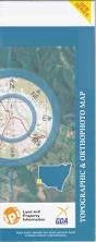
NSW 8332-S
Fifield
Digital Products: You will receive an email shortly after checkout containing links to download your products.
If you do not receive this email within 30min, please check your Junk / SPAM email folder, prior to contacting us.
Description
This Topographic Map is produced by the New South Wales Government.
This map is supplied in digital in PDF format, which means it can be printed at home or sent to a professional printer for a 100% scale reproduction.
At this scale, 2cm on this map represents 1km on the ground. A standard map (which is square) covers an area of approximately about 25km by 25km, with a contour interval of 10m. This map contains natural and constructed features including road and rail infrastructure, vegetation, hydrography, contours, localities and some administrative boundaries.
Flemington Boona West Meloola Wellwood Lara Carlisle Park Carlisle Nyora Wilga Lockerbie Avocavale Mayfield Belmont Kurrajong Grainee Baratta Bassett Carlisle Creek Colls Derriwong Derriwong Mountain Derriwong Mountain State Forest Ellerslie Elsmore Emu Plains Fifield Fifield Cemetery Fifield Racecourse Fifield Tank Ghost Ghost Hill Herring Jacks Plain Fiefield Fiefield Town Tank Village of Fiefield Fifield Public School Moorefield Public School Mount Tilga State Forest Mowabla Mowabla Tank Murga Murrumbogie Platina Platina Public School Reynolds Tank Scrubby Tank Sebastopol Taratta State Forest Tout Yarran Creek Hazel Brough Memorial Park Mount Herring Slaughtering Creek Jerula Boona Mountains Ghost Mountain Forest Vale Brooklyn Mowambla Tank Burando Bundaburra Tank