
NSW 8525-1N
Toolong Range
Digital Products: You will receive an email shortly after checkout containing links to download your products.
If you do not receive this email within 30min, please check your Junk / SPAM email folder, prior to contacting us.
Description
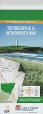
This Topographic Map is produced by the New South Wales Government.
This map is supplied in digital in PDF format, which means it can be printed at home or sent to a professional printer for a 100% scale reproduction.
At this scale, 4cm on this map represents 1km on the ground. A standard map (which is square) covers an area of approximately about 12.5km by 12.5km, with a contour interval of 10m. This map contains natural and constructed features including road and rail infrastructure, vegetation, hydrography, contours, localities and some administrative boundaries.
Bogong Creek Broadway Plain Clear Hill Cool Plain Corporal Hill Dargals Creek Emu Plain Far Bald Mountain Farm Ridge Fifteen Mile Ridge Green Creek Happy Jacks Creek Happy Jacks Plain Happy Jacks Pondage Hell Hole Creek Hendersons Creek Hut Creek Jagumba Jagumba Range Emu or Hell Hole Creek Happy Jacks River Lett Little River or Ogilvies River Macgregors Creek Mount Toolong or Bald Hill Mulligans Creek Musical Hill Ogilvies Creek Ogilvies Creek Picnic Area Ogilvies Dam Outstation Creek Pearces Creek Reardons Creek Round Mountain Ryries River Spencers Peak Thiess Thiess Village Tibeaudo Creek Tongue Bend Tongue The Toolong Toolong Creek Mount Toolong Toolong Plain Tooma Dam Tooma Reservoir Tooup Creek Trap Yard Creek Tumut River Two Up Creek Vale Diggers Creek Dodger Creek Doubtful Creek Doubtful Gap Doubtful River Cabramurra Round Mount