
NSW 8624-N
Numbla Vale
Digital Products: You will receive an email shortly after checkout containing links to download your products.
If you do not receive this email within 30min, please check your Junk / SPAM email folder, prior to contacting us.
Description
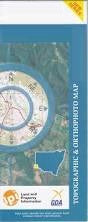
This Topographic Map is produced by the New South Wales Government.
This map is supplied in digital in PDF format, which means it can be printed at home or sent to a professional printer for a 100% scale reproduction.
At this scale, 2cm on this map represents 1km on the ground. A standard map (which is square) covers an area of approximately about 25km by 25km, with a contour interval of 10m. This map contains natural and constructed features including road and rail infrastructure, vegetation, hydrography, contours, localities and some administrative boundaries.
Dalgety Arthurs Creek Abington Back Creek Bairds Crossing Bald Hill Bald Hill Creek Bald Peak Bald Peak Creek Beehive Creek Beehive Spring Beloka Beloka Cemetery Biddi Big Popong Creek Big Rocks Creek Bobs Spring Creek Blakefield Black Jack Creek Blind Creek Blackburn Creek Blackburn Boundary Creek Box Ridge Brasseys Creek Gallows Creek Canoe Flat Chasm Gap Creek Cherry Tree Creek Cherry Tree Gully Coe Creek Coonhoonbula Crisps Creek Dans Creek Dead Horse Gully Deep Creek Deep Gulch Deep Gully Devils Hole Creek Fancy Flat Fancy Flat Creek Farm Creek Foxs Creek Gorman Yard Creek Guises Creek Guises Lake Guises Ridge Gulf Creek Gully Creek Gully Gap Creek Gully Lake Hickeys Crossing Highland Yard Creek Horse Creek Horse Flat Creek Horse Hill Ingebirah Peak Ironmungy State Forest Jillamatong Hill Lake Jillamatong Jimenbuen Jinkenbilly Gully Johns Peak Kellys Hill Kemps Creek Kerlewis Kerlewis Hill Dead Horse Creek Forest Hill Creek Forst Hill Great Popong Creek Guises or Sheep Station Creek Guises Range The Gulf Siding The Gulf Gully or Tin Mine Creek Harolds Creek Ingebrya Peak Ironmungy Ironmungie State Forest Island Lake Plain Jinkenbilly Creek The Knoll Lankeys Range Lankeys Ridge Little Popong Creek Long Flat Long Gully The Long Plain Mcmahan Creek Maffra Maffra Lake Marrinumbla Matong Creek Matong Meadow Creek Milligans Mountain Minnigans Mountain Mitchells Creek Mount Napoleon Mulligans Mountain Murrumbuco Creek Napoleon Hill Numbla Numbla Creek Numbla Public School Numbla Vale Patsy Creek Paupong Peak Creek Pinchgut Creek Pine Hill Popong Popong Creek Pothole Creek Rams Head Creek Reedy Creek The Rocks Creek Rocky Conical Peak Russian Creek Russian Gully Scotchmans Creek Shaw Shaws Creek Shaws Hill Sheep Station Creek Slaughterhouse Creek Smith Halls Springs Spring Creek Spring Creek Lake Stockyard Creek Stony Creek Stony or Back Creek The Bald Hill The Black Scrub The Devils Hole The Gullies The Meadows The Stony Pinch Third Creek The Three Brothers Tin Mine Creek Tin Mine Gully Tollbar Creek Tom Farm Creek Toms Farm Creek Tongaroo Tubbits Peaks Tubbits The Tubbards The Tubbuts The Tumbledown Bob Creek Two Tree Waterhole Washpen Creek Watering Creek West Lynne White Cow Creek Wild Woman Ridge Wilson Yellow Bull Creek Yellow Crossing Creek Bungarby Public School Lette Hill Barnes Crossing Guys Range Moonbah Moonbar Wullwye Creek Manara The Park Bobundara Boloka Bobundara Creek Bindango The Retreat Cattle Creek Iogebyra Ingebyra Ingebirah Ingebyrah Woodside Jimenbuan