
NSW 8625-2S
Wullwye Hill
Digital Products: You will receive an email shortly after checkout containing links to download your products.
If you do not receive this email within 30min, please check your Junk / SPAM email folder, prior to contacting us.
Description
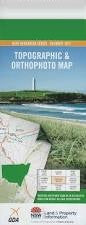
This Topographic Map is produced by the New South Wales Government.
This map is supplied in digital in PDF format, which means it can be printed at home or sent to a professional printer for a 100% scale reproduction.
At this scale, 4cm on this map represents 1km on the ground. A standard map (which is square) covers an area of approximately about 12.5km by 12.5km, with a contour interval of 10m. This map contains natural and constructed features including road and rail infrastructure, vegetation, hydrography, contours, localities and some administrative boundaries.
Arable Arable Creek Beloka Bobundara Cemetery Bobundara Hill Bobundara Boundary Lake Buckleys Crossing Buckleys Lake Bulgundara Bulgundara Creek Chapel Creek Coolamatong Coolamatong Lake Cottage Creek Dalgety Public School Dutton Creek Ingrams Creek Village of Dalgety Little Plain Little Plain Creek Manara Mount Pleasant Myack Creek The Rotten Rocks The White Rock Wolfram Hill Wullwye Wullwye Hill Wullwye State Forest Gordon Woolpack Creek Coolamateng Kara Creek Severn Park Boloka Creek Beloka Creek Myalla Creek Wullwye Creek Dalgety