
NSW 8627-3N
Bobbys Plains
Digital Products: You will receive an email shortly after checkout containing links to download your products.
If you do not receive this email within 30min, please check your Junk / SPAM email folder, prior to contacting us.
Description
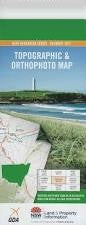
This Topographic Map is produced by the New South Wales Government.
This map is supplied in digital in PDF format, which means it can be printed at home or sent to a professional printer for a 100% scale reproduction.
At this scale, 4cm on this map represents 1km on the ground. A standard map (which is square) covers an area of approximately about 12.5km by 12.5km, with a contour interval of 10m. This map contains natural and constructed features including road and rail infrastructure, vegetation, hydrography, contours, localities and some administrative boundaries.
Armours Creek Bobbys Plains Boambolo Hill Bramina Creek Chinamans Creek Cromwell Mount Cromwell Crupper Gully Franklin Gully Gang Gang Gass Creek Horse Creek Crupper Creek Branch of Horse Creek Mountain Lickhole Mount Lickhole Limestone Creek McDonald Creek Mcdonalds Flat Merrymans Flat Micalong Swamp Myers Creek Napier Nimbo Oaks Creek Pheasant Creek Roast Beef Creek Saltwater Creek Sandy Flat Sandy Flat Creek Sulky Alex Hill Tommys Flat Yankee Ned Hill Dinnertime Creek Bull Flat Creek Brindabella County of Buccleuch Bramine