
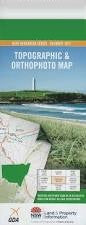
NSW 8724-1N
Nimmitabel
Digital Products: You will receive an email shortly after checkout containing links to download your products.
If you do not receive this email within 30min, please check your Junk / SPAM email folder, prior to contacting us.
Description
This Topographic Map is produced by the New South Wales Government.
This map is supplied in digital in PDF format, which means it can be printed at home or sent to a professional printer for a 100% scale reproduction.
At this scale, 4cm on this map represents 1km on the ground. A standard map (which is square) covers an area of approximately about 12.5km by 12.5km, with a contour interval of 10m. This map contains natural and constructed features including road and rail infrastructure, vegetation, hydrography, contours, localities and some administrative boundaries.
Nimmitabel Bemboka River The Big Bog Big Bog Creek Bombala River Brown Mountain Brown Mountain Lookout Cochrane Lake Coghills Rock Colombo Carters Creek Crab Creek Creams Creek Darbys Gully Emerald Georges Creek Glenbog Glenbog State Forest Grandfathers Creek Greens Creek Halls Gully Ingebirah State Forest Jettiba Jettiba Creek Jones Farm Creek Darbys Flat Fred Piper Memorial Lookout Georges Gully Jones Creek Maclaughlin Railway Station Monaro Range Nimmitibel Nimmitabel Post Office Nimmitabel Public School Nimmitybelle Numeralla River Nunnock River Packers Creek Packers Flat Pigring Creek Pipe Clay Creek Pipers Lookout Pole Creek Rutherford Creek Sawpit Gully Square Range Steeple Flat Stony Creek Tea Gardens Creek Thorntons Creek Thorntons Gully Warregal Corner Winifred Brown Mountain Flora Reserve Cochrane Dam Greenlands Werri Berri Hillside Tea Gardens Big Bog