
NSW 8726-3S
Bredbo
Digital Products: You will receive an email shortly after checkout containing links to download your products.
If you do not receive this email within 30min, please check your Junk / SPAM email folder, prior to contacting us.
Description
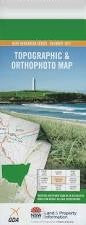
This Topographic Map is produced by the New South Wales Government.
This map is supplied in digital in PDF format, which means it can be printed at home or sent to a professional printer for a 100% scale reproduction.
At this scale, 4cm on this map represents 1km on the ground. A standard map (which is square) covers an area of approximately about 12.5km by 12.5km, with a contour interval of 10m. This map contains natural and constructed features including road and rail infrastructure, vegetation, hydrography, contours, localities and some administrative boundaries.
Bredbo Birchams Creek Boggy Creek Booths Gully Bransby Bredbo Public School Bredbo Railway Station Brineys Farm Binneys Farm Creek Brineys Farm Creek Brineys Farm Gully Buchans Creek Bullanamang Bullanamang Lake Cappanana Creek Clear Mount Clear Colyers Creek Connollys Gap Cosgrove Cosgrove Creek Cosgrove Hill Deep Creek Delegate Five Hundred Acre Creek Flinders Mount Flinders Gungoandra Gungoandra Creek Gungoandra Gap Hayes Creek The High Forest Hole Creek Deep Gully Joes Swamp Long Flat Creek Mcguigans Point Meringo Middle Creek Middle Ridge Mountain Ash Creek Murrumbucca Creek Railway Gully Reedy Creek Reynolds Creek Roberts Mountain Mount Roberts Rock Hut Creek Round Hill Sandy Creek Snowy Creek Snowy Gully Spring Vale Spring Vale Creek Teatree Swamp Creek Teatree Swamp Flat Top Flats The Top Flats Townsend Village of Bredbo Mount Long Flat Strike a Light Creek Ryans Creek Boboyan Divide Scottsdale Bredbo River Tinderry Creek