
NSW 8728-4S
Dalton
Digital Products: You will receive an email shortly after checkout containing links to download your products.
If you do not receive this email within 30min, please check your Junk / SPAM email folder, prior to contacting us.
Description
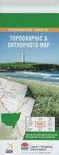
This Topographic Map is produced by the New South Wales Government.
This map is supplied in digital in PDF format, which means it can be printed at home or sent to a professional printer for a 100% scale reproduction.
At this scale, 4cm on this map represents 1km on the ground. A standard map (which is square) covers an area of approximately about 12.5km by 12.5km, with a contour interval of 10m. This map contains natural and constructed features including road and rail infrastructure, vegetation, hydrography, contours, localities and some administrative boundaries.
Back Creek Basin Creek Benbengeno Creek Blakney Creek Black Gully Branch of Blakney Creek or Little Plains Creek Dalton Dalton Public School Dalton Tank Devils Elbow Felled Timber Creek Flacknell Creek Greendale Greendale Creek Handys Creek Hudson Park Jerrawa Creek Town of Dalton Kildare Creek Langs Creek Little Plains Creek Midgee Range Mistake Creek Oolong Creek Sams Creek Savages Creek Sheep Station Creek Ti-Tree Creek Water Gully The Water Gully Western Branch of Felled Timber Creek Dirt Hole Gully Dowlings Creek Dry Creek The Dry Creek Bunton Bunton Creek Broadway Kildare Merrill Creek