
NSW 8937-2S
Plagyan
Digital Products: You will receive an email shortly after checkout containing links to download your products.
If you do not receive this email within 30min, please check your Junk / SPAM email folder, prior to contacting us.
Description
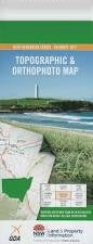
This Topographic Map is produced by the New South Wales Government.
This map is supplied in digital in PDF format, which means it can be printed at home or sent to a professional printer for a 100% scale reproduction.
At this scale, 4cm on this map represents 1km on the ground. A standard map (which is square) covers an area of approximately about 12.5km by 12.5km, with a contour interval of 10m. This map contains natural and constructed features including road and rail infrastructure, vegetation, hydrography, contours, localities and some administrative boundaries.
Violet Dale Wirrawee Reno Triangle Pembury Willeroy Lugwardine Burindi Appleogue Spion Kop Bonnie Downs Sherborne Aluna Back Creek Basin Creek Belmore Black Mountain Chinamans Creek Coxs Creek Dallons Hill Gap Creek Gulf Creek Hellhole Creek Lagoon Lagoon Mountain Lindesay Log Spring Gully Lower Sawpit Gully Myola Nandewar Nicholas Creek Oakey Gully Oakey Creek Oaky Creek Oaky Gully Onus Gap The Pinnacles The Pinnacle Mount Plagyan Ramyard Creek Red Hill Ringbark Hill Sandy Gully Slaty Gully Spring Gully Square Mountain Square Top Square Top Mountain Stoney Creek Stony Creek Studders Hill Tareela Creek Tea Tree Creek Teatree Creek Teatree Gully Tea Tree Gully The Whirlpool Burindi Gully Byar Mount Byar Mayvale Plagyan