
NSW 9133-1N
Barrington Tops
Digital Products: You will receive an email shortly after checkout containing links to download your products.
If you do not receive this email within 30min, please check your Junk / SPAM email folder, prior to contacting us.
Description
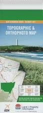
This Topographic Map is produced by the New South Wales Government.
This map is supplied in digital in PDF format, which means it can be printed at home or sent to a professional printer for a 100% scale reproduction.
At this scale, 4cm on this map represents 1km on the ground. A standard map (which is square) covers an area of approximately about 12.5km by 12.5km, with a contour interval of 10m. This map contains natural and constructed features including road and rail infrastructure, vegetation, hydrography, contours, localities and some administrative boundaries.
Allyn Range Allyn River Aeroplane Hill Bald Hill Barrington Barrington Falls Mount Barrington Basden Falls Ben Bullen Bibburah Creek Big Gully The Big Hole Big Jack Mountain Big Losy Mountain Big Lousy Mountain Big Rock Bobs Swamp Bobs Ridge Bobs Crossing Bluey Creek Bluey Gully Blue Gum Gully Blue Gum Flat Black Swamp Binalong Creek Brumlow Creek Caneens Gap Careys Peak Carters Brook Cedar Dump Chichester State Forest Cobbys Bluff Cobbys Falls Cobbys Gully Cockcrow Cockcrow Mountain Cockys Bog Gully Cones Brush Gully Coopers Gully Corang Gully Corker Mountain Eagle Hill Edwards Creek Edwards Plain Edwards Swamp Elbow Creek Emu Creek Eremeran Point Far Eastern Creek Far Eastern Falls Garden Gully Gillwinga Creek Giwarra Gully Governors Lookout Mount Gunama Jolliffes Gap Junction Pools Karawa Gully Kenneths Gully Cobbys Creek The Corker Eckford Downs Kindimidi Creek Kulmaren Gully Kungie Gully Kungie Rock Lagoon Pinch Landslip Gully Left Branch of Barrington River Left Hand Creek Little Losy Mountain Little Lousy Mountain The Long Ridge Losy Mountain Mount Lumeah Meehans Peak Meehans Peak Gully Micabil Gully Middle Branch of The Barrington River Mount Allyn Lookout Mount Lousey Myrtle Gully Oakey Gully Oaky Creek Oaky Gully O'Gradys Hut Oldcastle Mount Paterson Mount Patterson Pinnaburra Creek Pippita Gully Right Hand Creek Rocky Crossing Rocky Knob Lookout Sandy Flat Sawpit Gully Saxby Creek Saxby Swamp Scouts Alley Sempills Creek Sheepstation Creek South Arm of Stewarts Brook Spring Creek North Arm of Stewarts Brook Stony Point Tarrawonga Creek The Spring Timbarra Gully Tweedie Creek Tyawan Gully Wallaby Hill Wallen Mount Wattle Ridge Weemata Creek Mount William Williams Falls Williams Spring Wombat Creek Woolar Gully Yelgun Gully Doon Double Falls Diggers Creek Bungarie Creek Burraga Swamp Blue Gum Flora Reserve Barrington Tops Tops To Myalls Heritage Trail Woolooma Stewarts Brook Malvern Mount Cockcrow