
NSW 9137-4S
Bundarra
Digital Products: You will receive an email shortly after checkout containing links to download your products.
If you do not receive this email within 30min, please check your Junk / SPAM email folder, prior to contacting us.
Description
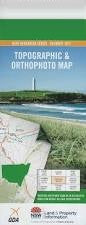
This Topographic Map is produced by the New South Wales Government.
This map is supplied in digital in PDF format, which means it can be printed at home or sent to a professional printer for a 100% scale reproduction.
At this scale, 4cm on this map represents 1km on the ground. A standard map (which is square) covers an area of approximately about 12.5km by 12.5km, with a contour interval of 10m. This map contains natural and constructed features including road and rail infrastructure, vegetation, hydrography, contours, localities and some administrative boundaries.
Avondale Minbah Belabula Shanakill Warrigal Woorabinda Gibraltar Prestbury Georges Creek Pine View Bindelong Swan Reach Shaldon Birrida Laura Caloola Winscombe Bundarra Chowbers Waterholes Clerkness Darbysleigh Emu Gully Gilgai Gully Harpers Gully Larrys Waterholes Mintons Waterholes Mt Drummond Public School Sandy Beach Public School Sentry Box Sentry Box Creek Sentry Box Hill Sentry Box Swamp Spring Creek Bundarra Post Office Drummond Bundarra Central School Bundarra Public School Drummond Creek Moredun Creek Clerks Creek Kellys Creek Moredun Clerks Creek Bakers Creek Laura Creek Sandy Creek King Johns Creek