
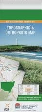
NSW 9435-2N
Telegraph Point
Digital Products: You will receive an email shortly after checkout containing links to download your products.
If you do not receive this email within 30min, please check your Junk / SPAM email folder, prior to contacting us.
Description
This Topographic Map is produced by the New South Wales Government.
This map is supplied in digital in PDF format, which means it can be printed at home or sent to a professional printer for a 100% scale reproduction.
At this scale, 4cm on this map represents 1km on the ground. A standard map (which is square) covers an area of approximately about 12.5km by 12.5km, with a contour interval of 10m. This map contains natural and constructed features including road and rail infrastructure, vegetation, hydrography, contours, localities and some administrative boundaries.
Mingaletta Wanda Ville Crystal Brook Yarrabee Park Illa Langi Racecourse Head Delicate Nobby Oaklands Green Valley Sun Valley Cooperabung Creek Dicks Hill Orange Grove Shirldon Avenel Crestwood Cornberry Park Pleasant Plains Ferndale The Island Minnamurra Broken Bit Ana Branch Maria River Mount Allen Allen Hill Ballengara Ballengarra The Big Hill Big Hill Point Boomerang Island Cooperabung Cooperabung Hill Dalhunty Island Fentons Island Hacks Ferry Cooperabung Mountain Maria Anabranch Muddy Creek Muddy Gully Noonan North Shore Beach Point Plomer Prospect Red Hill Roberts Plain Saltwater Lake Telegraph Point The Hatch Torrens Anabranch Torrens Island Torrens River Limeburners Creek Queens Head Telegraph Telegraph Point Public School Telegraph Point Railway Station Wilson River Sports Ground Torrens Connection Creek Race Course Headland Green Point Wilson River Pipers Creek Piper Creek Gulginni Webbers Creek