
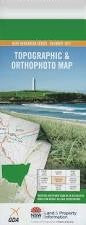
NSW 9641-3N
Cudgen
Digital Products: You will receive an email shortly after checkout containing links to download your products.
If you do not receive this email within 30min, please check your Junk / SPAM email folder, prior to contacting us.
Description
This Topographic Map is produced by the New South Wales Government.
This map is supplied in digital in PDF format, which means it can be printed at home or sent to a professional printer for a 100% scale reproduction.
At this scale, 4cm on this map represents 1km on the ground. A standard map (which is square) covers an area of approximately about 12.5km by 12.5km, with a contour interval of 10m. This map contains natural and constructed features including road and rail infrastructure, vegetation, hydrography, contours, localities and some administrative boundaries.
Bogangar Hastings Point Blacks Creek Black Creek Bogangar Beach Cabarita Beach Cabarita Beach Lions Park Christies Creek Cudgen Cudgen Creek Cudgen Headland Cudgen Lake Cudgen Public School Duranbah Public School Cudgen Scrub Public School Cudgera Headland Kingscliff Kingscliff Public School Leddays Creek Mcleods Creek Nories Head Norries Head Round Mountain Round Mountain Public School Stotts Channel Stotts Creek Stotts Island Stotts Island Nature Reserve Sutherland Point Kingscliff High School Faulks Park Bruce Chick Conservation Park Chinderah Duranbah Tanglewood Koala Beach Cudgen Nature Reserve Kings Forest Casuarina South Kingscliff South Kingscliff Beach Casuarina Beach Norries Cove Maggies Beach Hungerfords Hill Boyds Channel Dodds Island Broadwater McLeods Creek Clothiers Creek Coast Hill Boggangar Headland