
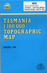
TAS 8113
Nive
Digital Products: You will be forwarded a copy of your digital product via email the following business day.There are no automatic download services available for Tasmap digitial products.
Digital Limitations: Please note that the digital version of these maps DO NOT contain borders, legends, scales, etc. Where a product covers multiple areas, each area is provided as a seperate file. These may not be suitable for use as a print product.
Description
This Topographic Map is produced by the Department of Primary Industries, part of the Tasmanian Government.
These maps are an important resource for Government, industry, and the public. They are used for environmental and emergency management, farm planning and mineral exploration. They are also popular for recreational users such as bushwalkers, mountain bike and horse riders.
The PDF version of this can be printed at home or sent to a professional printer for a 100% scale reproduction.
At this scale, 1cm on this map represents 1km on the ground. A standard map (which is square) covers an area of approximately 54km by 54km, with a contour interval of 20m. This map contains natural and constructed features including road and rail infrastructure, vegetation, hydrography, contours, localities and some administrative boundaries.
Tasmania Tarraleah Wayatinah Algonkian Mountain Algonkian Rivulet Dreaper Creek Dunnys Creek Dunnys Dam Dyes Marsh Dyes Rivulet East Bay Echo Point Arrow Tarn Australia Tarn Bakers Creek Banana Lake Battle Creek Battle Ridge Battlement Hills Bawleys Peak Bayeux Bluff Bedlam Wall Beech Creek Beehive Canal Beehive Creek Bens Marsh Bethune Creek Big Nive Rivulet Binney Dam Birds Saddle Blue Creek Bosworth Hill Bradys Creek Bradys Dam Bradys Lake Broken Leg Creek Bronte Bronte Bay Bronte Canal Bronte Dam Bronte Flume Bronte Lagoon Bronte Park Brown Marsh Creek Burns Creek Burns Dam Burns Plains Butlers Gorge Butlers Weir Byron Gap Caernarvon Ridge Calders Lookout Calders Shelf Camp Corner Canal Bay Canal Dam Carbonate Creek Cavalier Creek Cheyne Range Church Peak Clarence Lagoon Clarence Pipeline Clarence River Clarence Weir Clark Dam Claypit Bay Coal Hill Coates Creek Cockatoo Hill Counsel River Coxs Creek Cromwell Rise Cunninghams Knoll Currant Bush Shore Cuvier River Cuvier Valley Cynthia Bay D'Arcys Bluff Darkes Peak Deep Shore Denison Gap Derwent Basin Derwent Bridge Diamond Peak Divide Creek Doddridge Shore Dolly Hill Domesday Bluff Ely Creek Erebus Rivulet Eucryphia Lead Everlasting Hills Eyles Creek Eyles Marsh False Dome Fergys Hill Fife Hill First Bay Firths River Flame Peak Flood Creek Florentine River Fly Corner Forgotten Lake Frankland Beaches Franklin Tarns Gravestone Marsh Griffiths Creek Gell River Glow Worm Creek Godwin Tarn Golden Cloud Swamp Goodwins Moor Gordon Range Guelph Basin Guelph Narrows Guelph River Hamilton Creek Hanlon Creek Heals Spur Hereward Crag Hornes Creek Hornes Dam Hugel River Hunns Creek Hut Bay Ida Bay Ina Lagoon Innes High Rocky Iris Ponds Island Shore Jacks Gap Kenneth Creek Kenneth Lagoon King Charles Head King William Creek King William Levee King William Plains King William Range King William Saddle Lake Adela Lake Anne Lake Arlette Lake Beatrix Lake Binney Lake Catherine Lake Daphne Lake Dixon Lake Eleanor Lake Eva Lake Eve Lake George Lake Helen Lake Hermione Lake Ina Lake Kaljee Lake King William Lake Knight Lake Lancaster Lake Laura Lake Laurel Lake Liapootah Lake Mingundie Lake Nive Lake Oenone Lake Petrarch Lake Richmond Lake Rufus Lake Sally Jane Lake Sappho Lake Solitude Lake St Clair Lake Stuart Lake Tudor Lake Undine Lake Vincent Lake Warwick Lake York Lamonts Lookout Laughing Jack Dam Laughing Jack Lagoon Laughing Jack Marsh Leg o Mutton Marsh Liapootah Dam Liapootah Tunnel Little Hugel Little Navarre River Little Nive Rivulet Little Pine River Loddon Bluff Loddon Range Long Arm Long Bay Long Shore Majors Lookout Margaret Pass Mary Ann Creek McKays Peak Middle River Milligans Peak Misery Creek Mossy Marsh Canal Mossy Marsh Creek Mossy Marsh Dam Mossy Marsh Pond Mossy Marsh Tunnel Mount Arrowsmith Mount Byron Mount Charles Mount Cuvier Mount Gell Mount Harold Mount Hobhouse Mount Hugel Mount Ida Mount King William I Mount King William II Mount King William III Mount Manfred Mount Olympus Mount Orthys Mount Pitt Mount Ronald Cross Mount Rufus Mount Shakespeare Narcissus Bay Navarre Plains Navarre River Needle Rock Tarn Nichols Junction Nive Hill Nive Lagoon Nive Marsh Rivulet Nive Plains Nivelle Rivulet Norman Bluff North Shore Observation Peak Odo Tarn Orange Creek Orites Falls Owens Tarn Penelope Creek Philps Lookout Pine Tier Dam Pine Tier Lagoon Portal Bay Powers Creek Prince Rupert Pools Pump House Point Pump Pond Rainbow End Red Rocks Shore Restoration Hill Reverend Creek Reward Creek Richmond Falls Rim Lake River Derwent Robinson Creek Rouen Tarn Rowallan Bay Rufus Canal Rufus Rivulet Sanctuary Falls Sassafras Shore Saxon Creek Scoparia Lake Serpentine Rivulet Weir Seven Apostles Shadow Lake Shirleys Pool Skullbone Plains Slalom Creek Slatters Peak Snake Tier Snow Plains South Bay Squires Creek Squirrel Creek St Clair Dam St Clair Lagoon St Clair Lagoon Conservation Area St Clair Weir Stile Corner Stuart Creek Surprise River Surprise Tarn Surveyors Memorial Reserve Switchyard Bay Taffys Creek Tailers Bay Tarraleah Canal No 1 Tarraleah Canal No 2 Tarraleah Golf Course Teneriffe Marshes The Beehive The Chimera The Font The Hippogriff The Park The Spires Tibbs Plain Travellers Rest Lagoon Travellers Rest Lake Travellers Rest River Tudor Crag Tungatinah Creek Tungatinah Dam Tungatinah Lagoon Twin Lakes Vale Of Rasselas Watersmeet Wayatinah Dam Wayatinah Golf Course Wayatinah Lagoon Wentworth Canal Wentworth Creek Wentworth Dam Wentworth Hills Wessex Tarn Whitewater Point Wilsons Creek Wilsons Falls Wombat Glen Woodwards Bay Woodwards Canal Woodwards Creek Wylds Craig Access Creek Angevin Ridge Battle Hill Bradys Canal Bradys Spillway Bronte Canal Bridge Brown Marsh Creek Bridge Camp Cascades Camp Creek Cinnabar Creek Clarence River Bridge Coates Creek Bridge Cobbs Hill Corfe Castle Derwent Bridge Conservation Area Double Spire Ely Hill Forster Creek Fortress Rock Frankland Range Franklin River Bridge Gowan Brae Grassy Corner Haldane Peak High Spire Home Reach Joes Bay Kenneth Tier King William Creek Bridge King William Plain Lake Binney Forest Reserve Lake St Clair Tourist Road Bridge Liapootah Lionheart Crag Little Gell Lookout Little Navarre River Bridge Marlborough Mossy Marsh Mount Gibbins Navarre River Bridge Nive River Bridge No 1 Pond No 2 Canal Bridge Outer Spire Plantaganet Walls Platypus Bay Ringwood Bank River Derwent Bridge Road Shore Rufus Falls Rufus Walls Saxon Tarn Serpentine River Bridge South Peak Spillway Bay Spiral Cluster Taffys Creek Bridge Tarraleah Canal Bridge Tarraleah Forest Reserve The Divide Tower Rock Tungatinah Creek Bridge Tungatinah Forest Reserve Wentworth Creek Forest Reserve Woodwards Canal Bridge Lake Lemoine Little Nive River Little River Lake Petrach Lake Saint Clair Traveller Range Hugel Creek Pine River Serpentine Creek Bedlam Walls Woodward Creek DArcys Bluff Mount King William Island Bradys Marsh Rufus River Number Two Canal Bridge Nive River Warnes Lookout River Peak North Gum Ridge Prince of Wales Range